High Resolution DEM Map for

|
||

|

|

|

|
Click anywhere on the map to get a more detailed map.
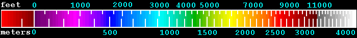
The elevations correspond to the following legend:
Overlaid on the elevation map are data from the USGS DLG (Digital Line Graphics) database. The database offers locations of states, counties, roads, railroads, parks, forests, rivers and lakes. Plotted on these maps are:
- White - State, country, coast outlines
- Gray - County outlines
- Black - Rivers and major streams
- Red - US Highways
- Light red - Interstate Highways
- Magenta - National Parks and Monuments